Wednesday, July 08, 2009

Brigham City to Honeyville bike route, 20 miles

The old Honeyville Elementary School

I was visiting my parents in Brigham this week and decided to take a ride to Honeyville. I haven't been there in years. It's a small town (smaller than Brigham), but I had some friends who lived out there when I was younger.


Llama sighting, best part of the ride

I took Main Street, but I might recommend either 300 West or 200 East as a route through town with less traffic. Main Street will turn into Highway 69 around 900 North.


Downtown Honeyville

It's a straight shot to "downtown" Honeyville. I was going to ride all the way to Crystal Springs (an tiny, old water park) but they were re-tarring the road just past "downtown" so I opted to head back from there.

Historical marker for Call's Fort


The route is basically flat. At most there's a 200 foot change in elevation from the highest to lowest points.

View of Brigham (in the distance)


For link to route map:
http://www.gmap-pedometer.com/?r=2987033

Safety

There's not a very big shoulder on the road. Also there are some big trucks that are carrying rocks or sand from a landfill.

I went when it was pretty hot too. Not too much shade. Bring enough water and wear sunblock.

Shingle Creek Trail, Uinta's


Location of trail head:
It's about 10miles up the Mirror Lake Highway from Kamas, on the north side of the road.

Approximate GPS coordinates (if I zoomed in on Google Earth correctly) are:
40 deg 36'39.72"N 111 deg 07'27.53"W (elevation 7601 ft)

My group hiked up about 3 or 4 miles with our packs then made camp. Then we continued up to East Shingle Creek Lake, about another 4 miles.


The beginner group (never been camping/backpacking before ever) went back for naps and a few of us decided to go to the peak of a nearby mountain. Not sure on that distance. I believe the elevation was 10850ish ft. (GPS: 40 deg 40'41.67"N 111 deg 03'40.44" W) The view was worth the work. It was also fun to slide back down some of the slopes on the snow.

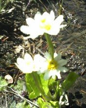
There were a lot of wildflowers blooming, which I enjoyed.


Safety
The trail was muddy in a few spots thanks to a rainy spring. No complaints, I love the green. There was also a creek we had to cross that covered the trail. It went almost up to my knees in the deepest part I was in.
It got quite cold, quite fast, once the sun went down. Nothing a couple of layers couldn't help though.


We made a really yummy dinner though. Pasta with sauteed vegis and pesto. Mmmmmm.

Wednesday, June 10, 2009

Quarry Trail


I've run this trail a couple of times with the Salt Lake Track Club and hiked it once. It's one of my favorite trails in the Salt Lake Area. It follows a river up the Canyon. The views of the granite slopes are amazing. It was so green right now too. The river is very high right now. I love the sound of it rushing down the canyon.


This is a tough run (for me). There are some decent steep parts for running. I went with a friend and we stopped to walk a few times. Just walking, I don't think it's too bad. I've seen kids there. On good days I've seen families taking pictures by the river.


I don't know how far up the trail actually goes. The SLC Track Club always went to the old church and turned around there. It looks like there's more trial. The "church" is about 3 or 3.5 miles up. I was told the old stone building was the church that the workers used when they were cutting the granite blocks for the Salt Lake Temple in the 1800's. There was a whole camp of rotating workers, so they built the church so they could hold services on Sunday. I also heard it suggested it is a mill because it's next to the water. There seems to be more of a story behind the church theory though. If I ever find out for sure, I'll update. Either way, it's cool if you are into old ruins.
Location

The trail head for the Quarry Trail is right at the mouth of Little Cottonwood Canyon. If that lot is full there is a park & ride lot on the North side of the road that you can also park at.


Safety

The river is very strong, don't fall in
This is a popular mountain biking trail, so keep a look out. If you go there with an mp3 player, keep the tunes down enough so you can hear people coming
Lots of rocks to trip over
Some of the trail has loose rocks that can cause slipping if running
It had rained this day, trail was muddy and slippery in a few spots

Thursday, June 04, 2009

Bonneville Shoreline Trail--North of Salt Lake section

I realized there are a lot of different sections of the Bonneville Shoreline. I'm not sure if there is a name for this section. It's the part I did before. I found the street up on the bench you can start at instead of hiking up from the City Creek Canyon area.


I was using this hike/run as part of my training for the Wasatch Back Relay. I hiked most of it going out. I ran a few little spots, but defintely hiked up the steep parts. Then I ran most of it back. I have a big downhill leg in the race, so I was targeting downhill this time.


I didn't notice this the last time I was there, but there was this large patch of irises blooming. Very pretty. I love purple irises.


I did see a pretty good sized snake close to where I turned around. If I had been running or biking at that time, I might have gone right over it before I noticed. It was just warming itself in the sun I think. I stood back and watch it for awhile. Eventually it slithered off and I went on. I wasn't feeling up to jumping over it so, that was almost the end of my hike/run.


Access

To get to the parking lot, take I street all the way up. It will turn into N Hills Drive, wind back around as Northmont Way/18th Avenue. On Google Maps the trail is shown as N Hilltop Road. That is where you turn in to park though.


View Larger Map

Safety


This is territory for rattlesnakes and blow/bull snakes. There has been a rare sighting of cougars in the foothills all along the Wasatch Front. I haven't heard of any incidents involving injuries, but stay aware of your surroundings.

There wasn't much shade past Memory Grove, so use whatever sun protection you prefer--sun block, hats, sunglasses, etc. Also take the right amount of water for you activity and length of time there.

I saw a lot of bikers. Be aware around some of the tight turns with limited visibility.

Note--For some reason I can't load pictures to the blog without it crashing. I will post them when this issue is resolved.

Product Review: Cliff Bar Black Cherry Almond

I used to eat Powerbars, but once you switch to Cliff it's hard to go back. I tried the Black Cherry Almond the other day. I liked it a lot.

It was a lot like a granola bar. You get actual chunks of fruit that can be identified as cherries. The almond chunks are pretty big too. It wasn't too hard to chew and I didn't get a stomach ache later, so I was impressed.

This one is probably one of my favorite Cliff flavors now.

Wednesday, May 27, 2009

Legacy Parkway Trail


I've been wanting to check this trail out for a long time, so I took my bike a few days ago and went most of the way. I've heard it's 13-14 miles in total, but I went out ten then turned back.
It's basically a two lane, paved trail. There's no shade other than some overpasses. There are some benches along the way. You get lovely view of people's backyards, scrub brush and a few wild flowers, highway, and a few industrial lots. I thought the views of the mountains were quite nice.


Access
I think I parked at the 2425 South trail head. The best way to get there is by way of Redwood Road. Turn West towards Legacy Parkway. You'll turn North towards Foxboro, but then take quick left and you'll be at the parking area. I don't know the exact address, but it's obviously off 2425 South as a general guideline.
Baseball field in Farmington
Safety
There's not much shade so be prepared, wear sunblock, bring enough water, etc.
There were quite a few other bikers, runners, walkers, and skaters, so keep an eye out for other people and use proper etiquette for whatever of those activities you are doing there.
I didn't see a lot of animals, but I know last year there were a lot of raccoons and skunks hit on the side of the road.

Tuesday, May 26, 2009

Memory Grove to Bonneville Shoreline Trail


The other day I went hiking for a couple of hours. I parked outside the gate to Memory Grove, 200 Canyon Road. I took the dirt trail on the right side of City Creek. When I got to the end I took the dirt trail that goes up to the Bonneville Shoreline trail. I've seen it before when I've gone up City Creek Canyon, but never taken it. Then I just wandered around up there for a bit. There are lots of trails all over the hills up above the city.

Route

When you get past the grassy area with all the monuments, you can choose between a paved road and a dirt trail up through the rest of the park. I took the dirt trail. Near the end there is a big bridge. Past this point the trail has some washed out sections and some of it is very steep. I don't recommend running this part, but it was kind of fun to hike it. Eventually I saw Bonneville Road to the East of the trail and scrambled up the bank of weeds to the road. A few meters down the road, I met up with the paved road from Memory Grove.


If you stay on Bonneville Road, you'll come to the entrance to City Creek Canyon. To the east of that road, there is the trail that leads up to the Bonneville Shoreline trails. It follows City Creek a little bit then criss-crosses up the mountain to the upper bench area.


From here, there are a lot of different trails that go just about every direction all over the hills north of the city. As it is spring, I saw a lot of wild flowers blooming and it was quite green. In a couple of more weeks it will all turn yellow, so I’m glad I got up there before that happens. I took roughly the same route back down, except I took the paved road through Memory Grove.


Safety

Trail past final bridge in Memory Groove is steep and not maintained. Also, I think I ran into a homeless man in the bushes. If that concerns you, take the bridge to the paved section.

I saw a couple of smaller snakes. This is territory for rattlesnakes and blow/bull snakes. There has been a rare sighting of cougars in the foothills all along the Wasatch Front. I haven't heard of any incidents involving injuries, but stay aware of your surroundings.

There wasn't much shade past Memory Grove, so use whatever sun protection you prefer--sun block, hats, sunglasses, etc. Also take the right amount of water for you activity and length of time there.

Monday, May 18, 2009

2009 Ogden Marathon Race Report

This was the 9th annual Ogden Marathon. Besides the marathon, this race includes a marathon relay, half marathon, 5K, and KidsK. I ran the half this year. I also put a niece and a nephew in the KidsK. This was both my first half ever and my first full marathon. So far it remains my favorite race because of a beautiful course and the dedication of the organizers.

The Start:

The race starts at Eden Park, up Ogden canyon on the North side of Pineview Reservoir. The main road in and out of the Huntsville Valley is closed for the race so there are shuttles for all of the race starting locations. All shuttles leave at 5:00 AM. All races start at 7:00 AM.

Some people find this a bit early to wait around 1 1/2 hours at the half start and will drive up there using an alternate route. I've never done this because it's too much of a hassle to have to wait until the canyon is reopened hours later and get a ride up to get my car.

The worst part of the race is waiting at the start line. It was in the 40's Saturday morning. Way too warm for spandex. This makes it tricky planning your attire because you need to be much warmer at the top than at the bottom. It was in the 70's in Ogden City when I finished. That's a 30 degree difference. While not comfortable to wait in for over an hour, you can complain or just have fun with it. Many people buy thrift store sweats that you can just throw away right before the start. They have the regular drop off bags for stuff you want back an huge bins for donated clothes you're tossing.

To help remedy the cold, they also have fire pits at the starting lines. If you're not up first, you won't get a prime spot next to a fire. I just squeeze my way into the middle of a couple of pits and suck up the residual warmth from the multiple fires and hundreds of bodies. It blocks the wind too.

This year someone stole half the TP from the porta potties at the half start. Not cool. Not cool at all. The organizers had a guy running for the store and brought some up as fast as they could but not before they got a lot of complaints. To whoever stole the TP, shame on you. It really irks me that the GOAL foundation goes to so much hard work to have some stupid punks even cause this kind of a problem. These people work too hard to have to run around buying TP at 5:00 in the morning. A couple of years ago they had some other vandals push porta potties over and steal water. If anyone does know who did this, please turn them in. I promise not to put a mob of angry runners together and dunk them in the porta potty if they get caught. All I want is a sincere apology to the race organizers.

Half Course:

The first mile is relatively flat. Then you hit the only major hill on the course. It's about 1/2 mile long and fairly gradual. Then it's about 3 slightly rolling but mostly flat scenic miles of lakeside and mountain views to the Pineview Dam. At the dam it's 5 miles of downhill. The first part and near the end are quite steep. Some people find their quads tighten up on this section. If you're tightening up, just pull over and stretch it out for a bit. The last about 4 miles is a pretty flat section along the Ogden River Parkway with the last mile going along Grant Avenue to the finish line.
I took the first two miles nice and easy. I find on courses that start with a downhill, I push too hard at the beginning. Since I knew a hill was coming, I didn't push very hard. The hill was a lot easier than I remembered. Of course I've been training for the Wasatch Back Relay and that has up mountain routes, so maybe I'm just better trained for the hills. I picked up my pace a bit on the section to the dam. Through the canyon I just let myself go and cruised through there. There are a few short spots that feel like they go up just a bit and I pushed to keep my pace on those too.

As soon as I got out of the Canyon I realized I was close to the 2 hour mark so I kept pushing the final miles. My previous PR was about 2:08 on the Provo River 1/2 and I performed terribly on the Moab 1/2 this year so I was pretty excited about this improvement. I think I got a bit of an adrenaline burst from that which help me push through to the end.

I called my parents on the final block of the race which is the final chute to the finish line. A bunch of people on the side were laughing and pointing cause I was on the phone. I wasn't conversing, I just mostly just breathing heavy. My dad has never been able to come to any of my races because of health problems. He was actually in the middle of a dialysis treatment at the time. It meant a lot to me to have him there even if it was just on the phone.

Pros/Cons

Cons
Very cold at the race start (can't control the weather)
Very early shuttle times (logistically this is necessary to start by 7:00 and get done before it gets hot)
A lot of downhill (not for some people's knees or hips)

Pros
Beautiful route (if you like lakes, snow capped mountains, rumbling rivers, towering waterfalls, parks, etc.)
Race is put on by a group of volunteers who genuinely care about the runners have the best experience possible
Well organized (see previous pro)
A lot of downhill (I do very well downhill, no knee problems ever on this race, so I love it)
Dedicated sponsors (not just monetarily, a lot of the sponsors have people involved in putting on the race)


My results
I had originally signed up for the 5K because the half and the full filled up so quickly this year (it's become a very popular race). I volunteered at the race expo on Friday and ran into an elementary school friend. Her sister's husband was signed up with them for the half but he got called into active duty that week. I took his bib and timing chip and ran in his place.

I got the 5k & the half chips confused, so I ended up wearing them both. Worst 5k time ever, best half. :) My final chip time was 2:01:35. Broke my previous PR by 7 minutes. I placed 753rd out of 1974 that completed (about 2,200 registered, what happened the other 200?) This is the first time I have been in the top half. I'm usually near the middle but just into the 2nd half. Needless to say, I am very happy with my results.

KidsK

The KidsK runs from 18th street to the finish line along Grant Avenue. It's the last mile of the race. It starts at 12:30 so most of the runners have finished by then.


Sadly only my niece was able to run it. The nephew took a fall almost in front of the starting line. His sunglasses gave him a one inch gouge on his forehead which required 5 stitches. Poor little fellow. The two kids had been talking about the race for the past two weeks. It broke my heart to see him get hurt. I felt totally responsible too since I registered him.

A giant thank you to the runners who stopped (after 5 1/2 hours of running, within sight of the finish) and tried to help out. One runner stayed with my mom & nephew for almost ten minutes until they got an ambulance there. Runners are good people.

About 15 minutes to start we saw my brother-in-law walking back with the niece. He told us what happened. She still wanted to do the race, so I threw her on my back and tried to trot back to the starting line as fast as I could at that point (not that fast). Daddy took son (who wanted his mommy) and my mom & I took the niece to the start (sans sunglasses as this point).

There were a few hundred kids in the KidsK. The purpose is to raise interest in recreation and fitness in kids and to raise money to enter kids who can't afford to participate. Also, they support fitness programs in schools around the county. All causes I approve of.

The niece was a bit wary at the first where everyone was crowded cause she's 3 and that's a lot of people. She had a blast though. She kept saying, "we're winning, we're winning." She'd sprint a bit and get tired. That's how the little ones seemed to all be doing it. We had to carry her for a couple of the blocks. We put her down the last two blocks though.

The kids all got finisher's cowbells. They gave us one for the nephew even though he didn't even get to start. The point is to get kids excited for fitness not emotionally or physically scare them for life. They had treats too--apples and carmel dip, bananas, chocolate milk, cookies, water, etc. I think McDonald's supplied all the kids' treats.

The nephew was doing fine after the stitches. Both kids can't wait to do another race.

Monday, May 11, 2009

Race Review: SLC Susan Komen Race for the Cure

The Course:

The course is fairly flat, so it's not a very difficult route. It started on 300 West and North Temple. West on 900 N then back south on 400 West. You turn into the Gateway at 100 S and run the last little bit through the center of the Gateway.

Link to course map:
http://www.gmap-pedometer.com/?r=2812905

Actual Event:

Unfortunately this morning did not go smoothly so it's hard to review this event completely. I met up with a group who was doing it as a team. While I am a supporter of Trax this was not it's finest hour. They are doing construction so all trains are on the same tracks. There was also a power outage on a section so they were running late. I actually saw 3 trains go by before we got on. The 1st one had room but it came by around 7:20 which was before the group met (7:30). The second two were full to capacity. We finally just pushed onto the next train.


The race was supposed to start at 8:30 but we didn't get there until 8:50. The race actually started about 10 mins late, so we were only 10 mins behind. I felt bad for all the many people we passed on other Trax stations that couldn't even fit on our train, so they got there even later. The real point of the event was to raise money for breast cancer research and to help educate the public. Mission accomplished.


I, however, also wanted to beat my PR. My last official 5K was a few years back and it was about 0:29:00ish. Starting the race late put us behind thousands of people. I shouldn't say we anymore. I ditched the group because most of them were walking. The point is, there were way too many people I had to dodge and weave around.

It was kind of fun to pass so many people, but it was especially efficient and walkers tend to do things like stop suddenly or change directions without looking around them to see who is going to run into them. I think if I had started at the beginning of the race, I wouldn't have had the bottleneck issues.


Parade of Survivors


The awesome part once I made my way into the mass of people was looking forward and back. It was like being in a sea or white and pink. There were so many people. When you get to the last almost quarter mile, there is no more running. The run/walk finishes through the Gateway. It's not wide enough for the number of people that participate, so you start moving along like livestock to a corral.

Another con is that you don't get an official time. They don't track individual times in any way. I actually have no idea what my time was. I looked at the time when I started and stopped and I came up with just under 17 mins. That is impossible. I can't run one mile in 6 minutes let alone 3. Obviously, I got confused on the timing some how so I have no idea how I really did.

Cons:
No official timing
Too many walkers if you don't start at the front
Crying (happy and sad) in public by reading people's back dedications


Pros:
Lots of good positive energy from participants
Lots of cheering on the sides
Funny people to look at
You can talk/shout about breasts all you want
Free capes while they last

Recommendations:

I do recommend this event. Not as a race though. Do it for fun and to support the cause. Take time to look around and read people's t-shirts. How many races do you see a matching pink bowling ball and pin walking down the street or men in bras?

Get there early. If you're going to use Trax, leave before 7:30 AM. You'll be standing around for awhile, but you'll get there on time. If you choose to drive, still go early. Traffic looked pretty bad too. I heard the 600 S exit was backed up pretty bad right before the race. If I do it again, I'll still take Trax.

These guys were the most popular people at the event