Location of trail head:
It's about 10miles up the Mirror Lake Highway from Kamas, on the north side of the road.
Approximate GPS coordinates (if I zoomed in on Google Earth correctly) are:
40 deg 36'39.72"N 111 deg 07'27.53"W (elevation 7601 ft)
It's about 10miles up the Mirror Lake Highway from Kamas, on the north side of the road.
Approximate GPS coordinates (if I zoomed in on Google Earth correctly) are:
40 deg 36'39.72"N 111 deg 07'27.53"W (elevation 7601 ft)

My group hiked up about 3 or 4 miles with our packs then made camp. Then we continued up to East Shingle Creek Lake, about another 4 miles.

The beginner group (never been camping/backpacking before ever) went back for naps and a few of us decided to go to the peak of a nearby mountain. Not sure on that distance. I believe the elevation was 10850ish ft. (GPS: 40 deg 40'41.67"N 111 deg 03'40.44" W) The view was worth the work. It was also fun to slide back down some of the slopes on the snow.

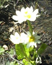
There were a lot of wildflowers blooming, which I enjoyed.

Safety
The trail was muddy in a few spots thanks to a rainy spring. No complaints, I love the green. There was also a creek we had to cross that covered the trail. It went almost up to my knees in the deepest part I was in.
It got quite cold, quite fast, once the sun went down. Nothing a couple of layers couldn't help though.

We made a really yummy dinner though. Pasta with sauteed vegis and pesto. Mmmmmm.

No comments:
Post a Comment